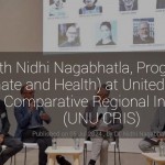
Interview with Nidhi Nagabhatla by the United Nations Office for Outer Space Affairs (UNOOSA)
The United Nations Office for Outer Space Affairs (UNOOSA) recently conducted an insightful interview with Dr. Nidhi Nagabhatla UNU CRIS’s Senior Research Fellow, featured on the Space4Water platform. This platform fosters interdisciplinary knowledge exchange on how space-based solutions and technologies can address water-related challenges, directly contributing to the vision of ensuring water security for all, as outlined in Sustainable Development Goal 6 (SDG6) of the 2030 Agenda.
In the interview, she emphasized the critical role that space technologies play in achieving sustainable water management and security. She highlighted the various ways in which actors, agencies, and regions are leveraging geospatial technologies to design innovative and sustainable solutions. These technologies, including satellite remote sensing, geographic information systems (GIS), and data analytics, are essential in monitoring, managing, and conserving water resources effectively. She also pointed out that geospatial technologies provide accurate and timely data, which is crucial for informed decision-making. This data helps in mapping water bodies, assessing water quality, predicting droughts and floods, and managing water distribution systems. For instance, satellite remote sensing can monitor surface water levels and quality, detect changes in water bodies over time, and provide early warnings for natural disasters like floods and droughts. GIS, on the other hand, allows for the visualization and analysis of spatial data, aiding in the planning and management of water resources at local, regional, and global scales.
The interview also discusses the importance of collaboration among various stakeholders, including governments, international organizations, academia, and the private sector. Such collaborations are essential to harness the full potential of space technologies in water management. She cited examples of successful projects and initiatives where diverse actors have come together to address water-related challenges. These collaborative efforts not only enhance technological capabilities but also promote knowledge sharing and capacity building, which are vital for achieving SDG6.
The interview also delved into the regional applications of geospatial technologies, showcasing how different parts of the world are utilizing these tools to address their unique water challenges. In regions prone to water scarcity, such as arid and semi-arid areas, satellite data helps in identifying potential water sources and monitoring their extraction to prevent overuse. In areas facing frequent floods, geospatial technologies assist in flood mapping and management, enabling authorities to take proactive measures to mitigate the impact.
She concluded that ensuring water security for all requires a holistic and integrated approach. This includes not only the application of advanced technologies but also the consideration of social, economic, and environmental factors. She stressed the need for policies and strategies that are inclusive and equitable, ensuring that the benefits of space technologies reach the most vulnerable and marginalized communities.
Please click here to read more.